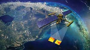

As climate change turns for the worse and sea-level rise threatens cities across the world, a new mission is in the final stages that will conduct the first global survey of Earth’s surface water and study ocean currents. The Surface Water and Ocean Topography (SWOT) mission will be launched in 2022 as engineers finish assembling the satellite.
A collaboration between NASA and the French space agency Centre National d’Etudes Spatiales (CNES), the mission will collect data on the height of Earth’s salt- and fresh water including oceans, lakes, and rivers enabling researchers to track the volume and location of water around the world.
“SWOT will be our first global snapshot of all surface water that we have now, how the water moves around the planet, and what happens to it in a new climate,” said Nadya Vinogradova Shiffer, SWOT program scientist. The mission will help the space agency in measuring the effects of climate change on the planet’s water, such as the processes by which small, swirling ocean currents absorb excess heat, moisture, and greenhouse gases like carbon dioxide from the atmosphere.
Researchers are hopeful that the mission will aid in following how much water flows into and out of the planet’s lakes, rivers, and reservoirs, as well as regional shifts in sea level.
TESTING AHEAD
With the assembling of the satellite complete, engineers will begin testing it under different scenarios prepping it for launch and readying it to gear for any eventualities in space. Nasa said that the next six months will involve three phases of testing to make sure the satellite will be able to survive the rigours of launch and the harsh environment of space.
During the testing phase, the satellite will be simulated to the intense vibrations and rattling of launch, bombarded with high-decibel sounds similar to those of blastoff and put into a chamber that mimics the temperature swings and vacuum of space.
While engineers gear up the hardware and the software, the science team is already working on data tools to extract future information. Researchers are using simulated data to put their analytic tools through their paces, as well as prepping for the period right after launch called “calibration and validation.” This is when researchers compare data from the satellite with measurements taken on the ground in order to ensure the science instruments are collecting data properly and measuring what they’re supposed to be measuring.
WHY DO WE NEED TO STUDY OCEANS?
Water is one of the biggest resources required to sustain life, however with climate change in full swing now, it will lead to major landscape and geographical changes in the coming decades. Therefore it becomes important to understand how much water sloshes around in Earth’s lakes, rivers, and oceans? And how does that figure change over time?
The data from this mission will help monitor changes in floodplains and wetlands, measure how much fresh water flows into and out of Earth’s lakes and rivers and back to the ocean, and track regional shifts in sea level at scales never seen before.
“It will provide information on small-scale ocean currents that will support real-time marine operations affected by tides, currents, storm surge, sediment transport, and water quality issues. And the information that SWOT collects will also provide, for the first time, global observational evidence of how circular currents, called eddies, contribute to changes in the ocean, such as to its energy and heat storage, as well as to how carbon moves through the marine environment,” Nasa said.


Leave a Reply